Basic Notions
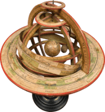
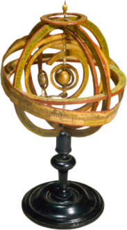
Armillary Spheres
Armillary spheres offer a mechanical model of the universe. These geared devices are composed of a series of concentric rings, or “armillaries” revolving on a central axis. Each ring holds one planet and turns around the Earth – in versions that respect Ptolemy’s theory – or the Sun, for those that follow Copernicus’s. Hence armillary spheres make the imaginary structure applied to the sky visible, in order to allow people to better comprehend it.
The first heliocentric spheres, which appeared circa 1700, co-existed alongside geocentric spheres for nearly a century. In fact, the Copernican and Ptomelean models were often displayed side by side. In addition to their educational and aesthetic value, armillary spheres were often “automated,” moving either manually or via a clockwork mechanism, so they were particularly fascinating and prestigious items to own.
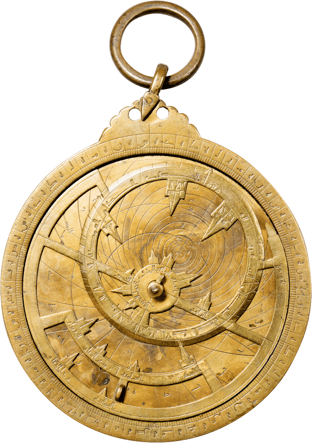
Astrolabe
Astrolabe means “star-taker” in Greek. An astrolabe is an ancient instrument that enables astronomical calculations through the movement of a “map” of the brightest stars in the sky relative to curves that make it possible to locate them from the place of observation. They display the daily motions of the sky on a flat surface.
Starting in the ninth century, astrolabes became extremely popular in the Arab world because they made it possible to determine prayer times and the precise moments of sunrise and sunset, as well as indicating the Qibla (direction of Mecca). A Greek invention perfected by scientists from the Arab world, astrolabes were a symbol of scientific modernity in medieval Islam.
Astrology
Astrology goes back at least to the seventh century B.C.E., when the Babylonians began to believe in the influence of the planets. At that time, omens based on observations of phenomena visible to the naked eye concerned only the King or the fate of the Kingdom. Horoscopic astrology, which predicts individuals’ futures based on the positions of the Sun, the Moon, and the five planets at the moment of their birth, didn’t appear until the late fifth century B.C.E.
Ptolemy’s Tétrabible (or Quadripartitum, in Latin) was the world’s most famous astrology treatise for a very long time. Astrology continued to develop in the Arabo-Persian world, first in Baghdad, then throughout the Islamic world. From the eighth to the fifteenth centuries, astrology, studied by countless scholars, experienced a true Golden Age. It was the science of judgment, while astronomy was the science of motion. Horoscopes were drawn up to determine the most auspicious time for battles, journeys, meetings, political decisions and more. Despite being criticized or sometimes even banned by religious leaders, astrology was established, to varying degrees, in towns and cities and in the courts of Arab princes. The break between astrology and astronomy didn’t occur until the Age of Enlightenment.
Astronomy
Astronomy is the science of observing and studying heavenly bodies and the universe in order to understand their origins and evolution, as well as their physical and chemical properties. Astronomy’s roots reach back to before Antiquity, and can be found in prehistoric religious practices.
Celestial Equator and Ecliptic
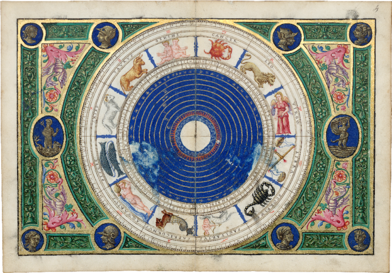
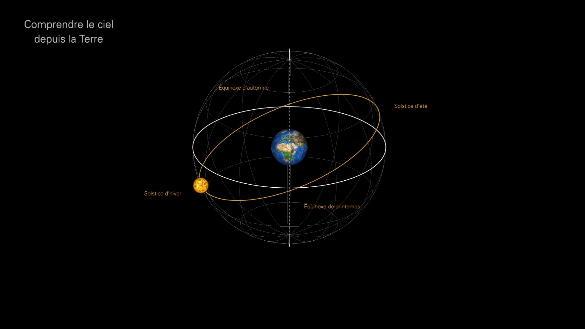
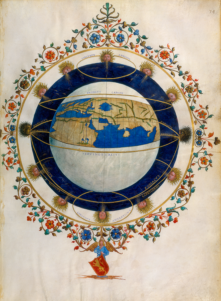
A celestial globe is a sphere showing the stars’ and constellations’ apparent positions in the sky. The sphere is gridded with circles based on phenomena observed in the sky that create a sort of imaginary framework. The most important of those circles are the celestial equator and the ecliptic; the latter represents the Sun’s annual path through the stars.
The equatorial plane is inclined by an angle of about 23.5° to the ecliptic plane, and intersects it at two points called the equinoxes. When the Sun reaches one of those two points, day and night are the same length. For observers in the northern hemisphere, that moment marks either the beginning of spring, when the Sun enters the sign of Aries, or of autumn, when it enters the sign of Libra. Two other points on the ecliptic plane coincide with important dates on the calendar: the summer solstice, when the Sun appears in the sign of Cancer – the longest day of the year – and the winter, when it enters into Capricorn – the shortest day of the year.
Circumference of the Earth
The rotundity of the Earth was known to the Greeks from the fifth century B.C.E. The first estimate of its circumference dates back to the third century B.C.E.: it was calculated by one of the foremost scholars in Alexandria, Eratosthenes of Cyrene (275-195 B.C.E.). With nothing more than a gnomon (a stake or column standing perpendicular to the horizon), he determined the difference in latitude between Alexandria and Syene (modern-day Aswan, Egypt), i.e. 1/50th of a circle, or approximately 7°. Taking the distance from Alexandria to Syene to be about 5,000 stadia, he concluded that the circumference of the Earth was approximately 252,000 stadia. Depending on the value of the length of a stade (the singular of stadia) used by different authors (it varies from 140.8 m. to 177.4 m., or 461.9 to 582 feet), the circumference of the Earth as calculated by Eratosthenes’s method would be between 35,000 and 44,700 km (24,000 to 29,000 miles). Posidonius (first century) later provided a more modest estimate of the Earth’s circumference: 180,000 stadia: that value is worth mentioning, because it is the one that Ptolemy popularized by including it in his Geography.
Circumnavigation
This term refers to navigating a ship around a geographical feature, which can be an island, a continent or even the entire Earth. As early as the late Middle Ages, the theoretical possibility of circumnavigating the globe was raised in the highly popular book, The Travels of Sir John Mandeville. The first round-the-world journey is attributed to the Portuguese explorer Fernand de Magellan, in the service of the Spanish crown. It took from 1519 to 1522: in November, 1520, having found a passage south of the Americas, Magellan reached the Philippines, where he was killed in a conflict with local people. His lieutenant, Juan Sebastian Elcano, completed the circumnavigation with a handful of survivors. Magellan would be followed by others: the Spaniard Garcia Jofre de Loaísa (1525-1536), the Englishman Francis Drake (1577-1580), and the Dutchman Olivier van Noort (1598-1601). Louis-Antoine Bougainville was the first French navigator to circumnavigate the globe (1766-1769).
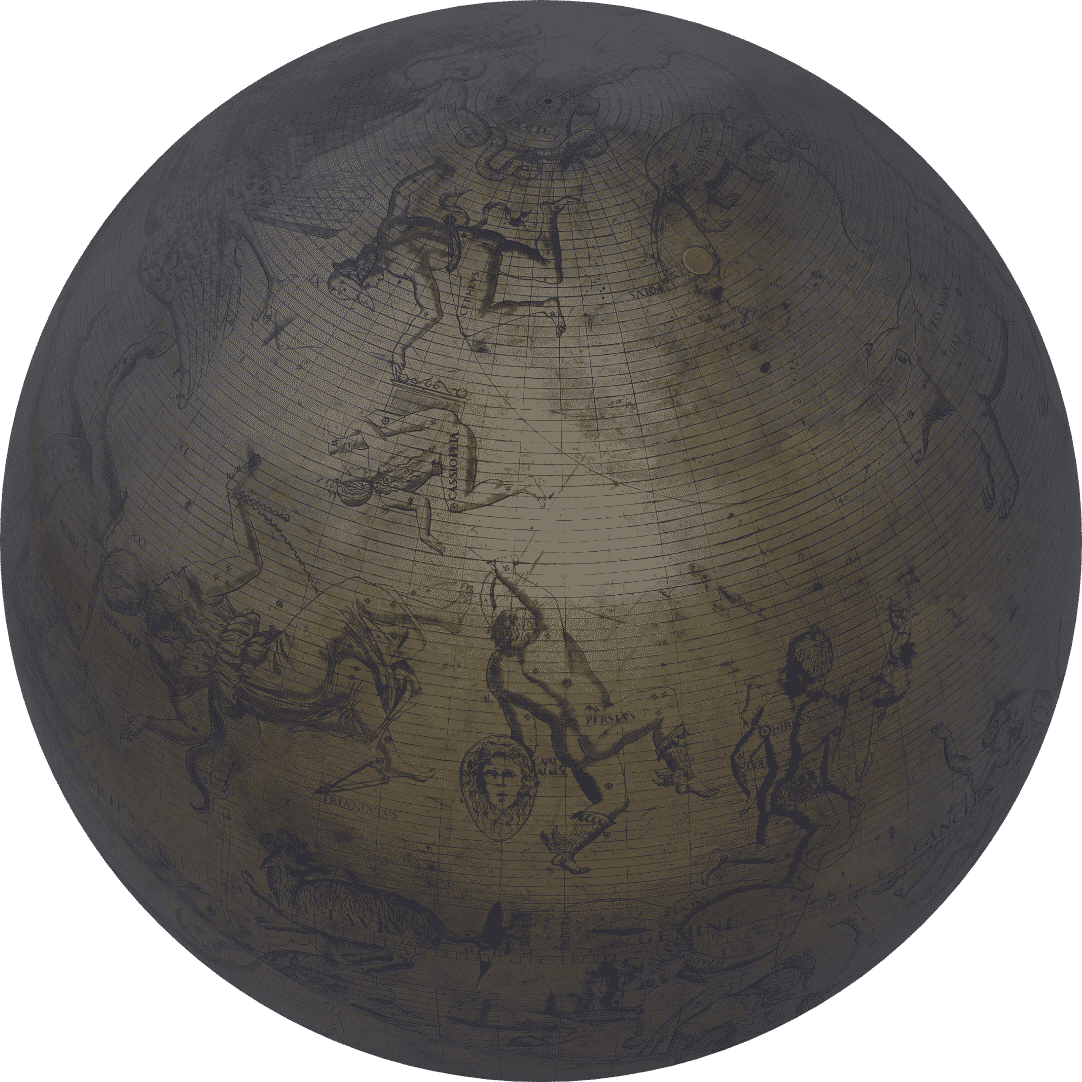
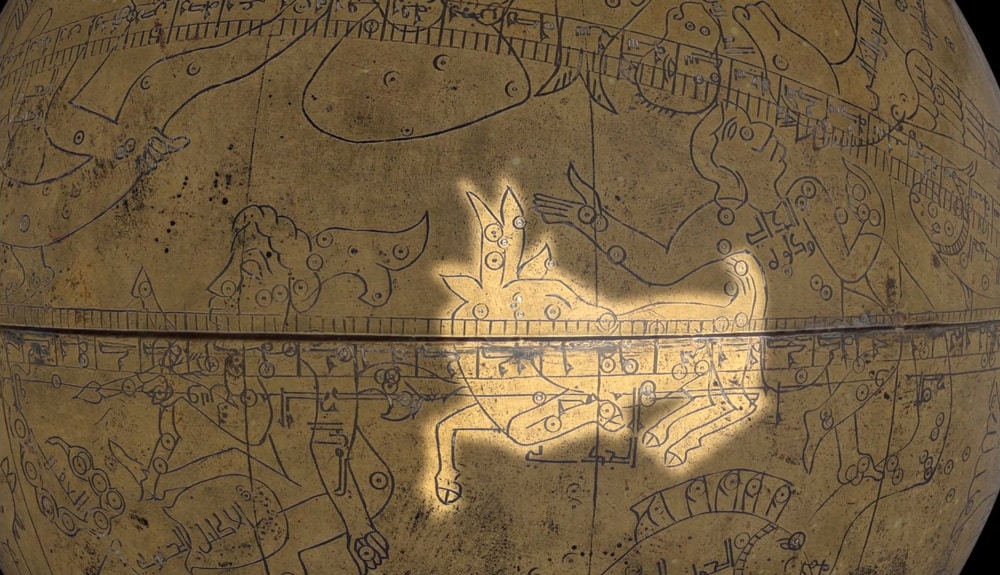
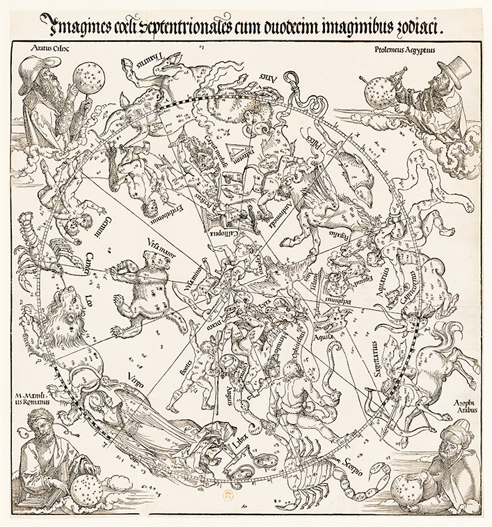
Constellation
Constellations are imaginary figures connecting stars: they often represent animals (like Ursa Major, Latin for “Great Bear,” a constellation that includes all the stars in the Big Dipper, or the Plough), or mythological heroes, like Perseus and Orion. They make it easier to identify and remember stars based on their position within constellations. Alkaid, for example, is a bright star at the tip of Ursa Major’s “tail.”
Cosmography
Geographers’ knowledge, paired with that of astronomers, was the basis of cosmography, a key subject in the sixteenth century’s pecking order of fields of scholarship. Cosmographers studied any branch of science that enabled them to better understand the world and its organization. Thus cosmography was at the crossroads of a great number of fields, including astronomy, astrology, mathematics, geography, and even philosophy.
> Downloadable map (PDF): From Cosmography to Astrophysics: Three Centuries of Discovery
Ecumene
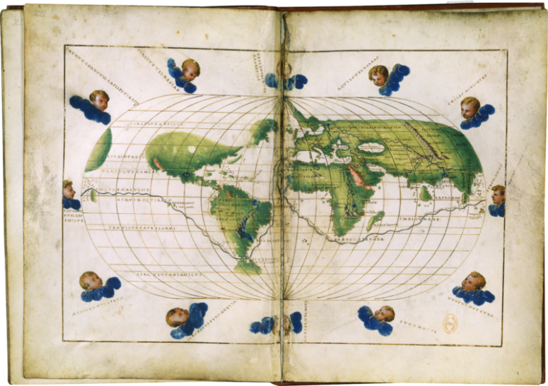
The word οἰκουμένη (oikouménē) was used by Ancient Greek scholars and philosophers to describe the world of the Greeks, as opposed to that of the Barbarians. For geographers, it meant, more broadly, the known, inhabited world. In Book I of his Geography, Claudius Ptolemy presents ways to draw maps and several different types of mathematical projections for representing all or part of a globe on a flat surface. Books II to VII propose a description of the inhabited world.
Equinox
The term equinox refers to the moment when day and night are of equal length. This occurs twice a year, when the Sun crosses the terrestrial equator, switching from one celestial hemisphere to the other.
The vernal equinox takes place on March 20 in the northern hemisphere. That is when the sun is at its zenith, i.e. at 90° at noon, for places along the equator (latitude 0°). Both nighttime and daytime last 12 hours.
During the summer, the sun gradually returns towards the equator, which it crosses once again on September 22, the autumnal equinox. The sun then drops below the equator: for those who live in the southern hemisphere, it is the first day of spring.
Fixed and Wandering Stars
For more than a thousand years, observable heavenly bodies were divided into two categories: “fixed stars,” which we still refer to as stars, and “wandering stars,” which we now call planets. In fact, the word planet comes from the Greek πλανήτης (planētēs), meaning “wandering.”
Flat Earthers
Although it has been known since Aristotle’s time in the fourth century B.C.E. that the earth is round, people known as “Flat Earthers” promote the theory of a flat Earth…
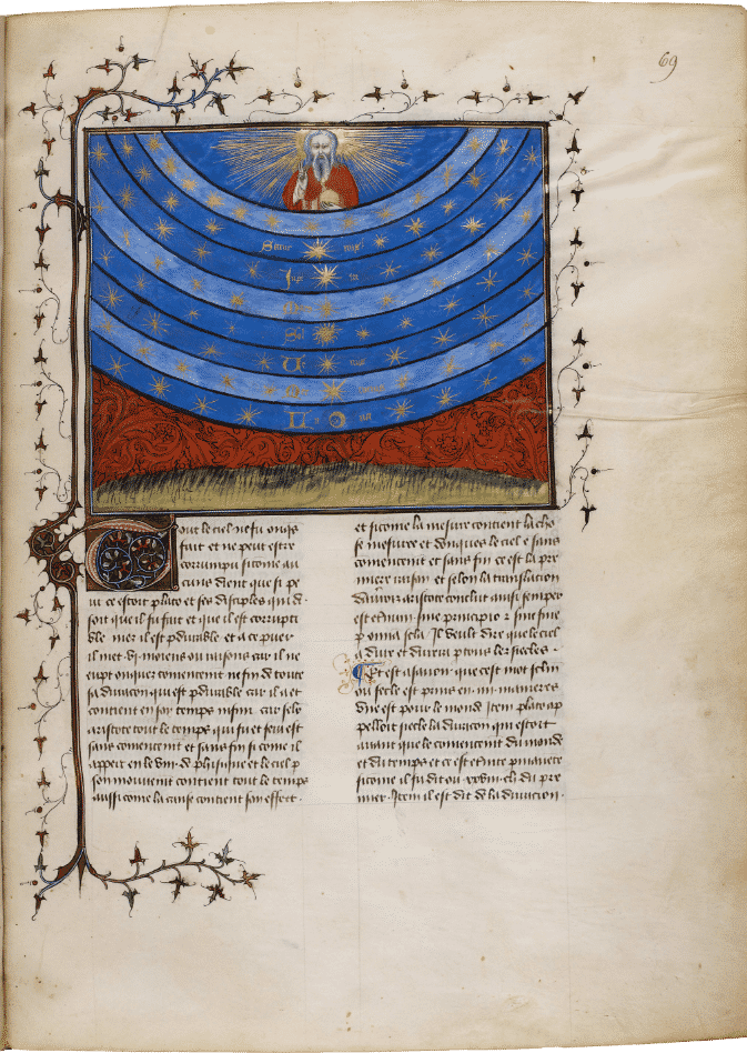
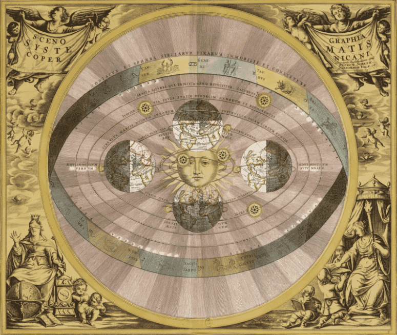
Geocentrism
Geocentrism is a cosmological model in which the spherical Earth is immobile at the center of the universe. This vision of the world, inherited from ancient Greece and theorized by Claudius Ptolemy, a second-century C.E. Greek geographer and astronomer, was not broadly replaced until the 16th century, or even later. Ptolemy’s geocentric model would eventually be challenged by Nicolaus Copernicus, who proposed a heliocentric one instead, i.e. one with the Sun at the center of the world.
Geoid
The term describes the surface coinciding with mean sea level (in the absence of tides, winds, and currents) and its projected extension below the continents. This surface is not smooth; it has permanent bumps and dips that reflect variations in terrestrial attraction caused by different masses within the Earth and by the topography of the sea bed.

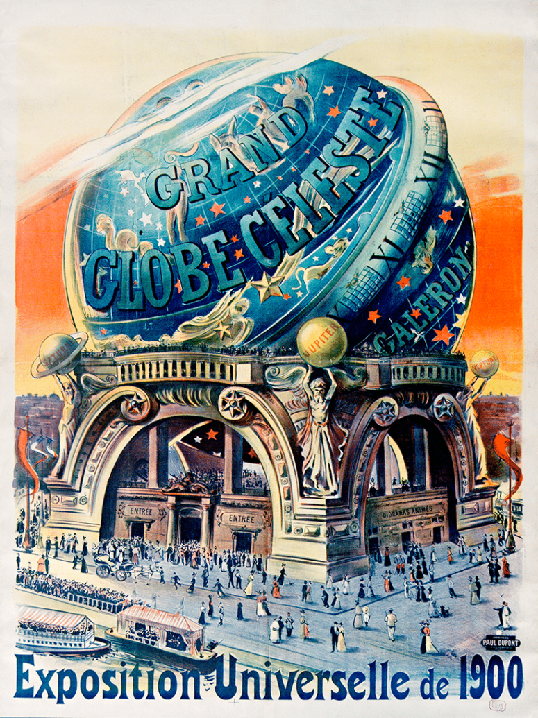
Georama / Cosmorama
A georama is a building whose interior is a hollow globe adorned with a representation of the Earth. This type of globe is called a concave sphere (as opposed to standard terrestrial globes, which are convex spheres). A spectator inside a georama can see the entire world map simply by turning around. Georamas were popular educational attractions. The world’s first georama opened on Paris’s Boulevard des Capucines in 1825.
It was the model for the architect Albert Galeron’s Grand Celestial Globe, or Cosmorama, which was built for the Paris World’s Fair in 1900. The Cosmorama’s outer surface was decorated with golden constellations on a blue background. Inside, the globe was strewn with stars. In the center, a small rotating Earth welcomed spectators. Settled into their seats, they could admire the panorama of celestial phenomena like the motions of the Sun, the stars, and the heavenly bodies.
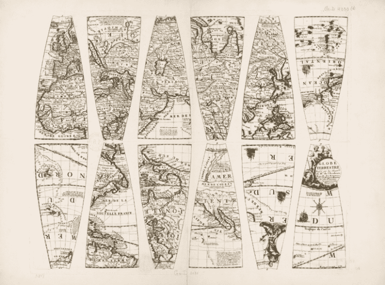
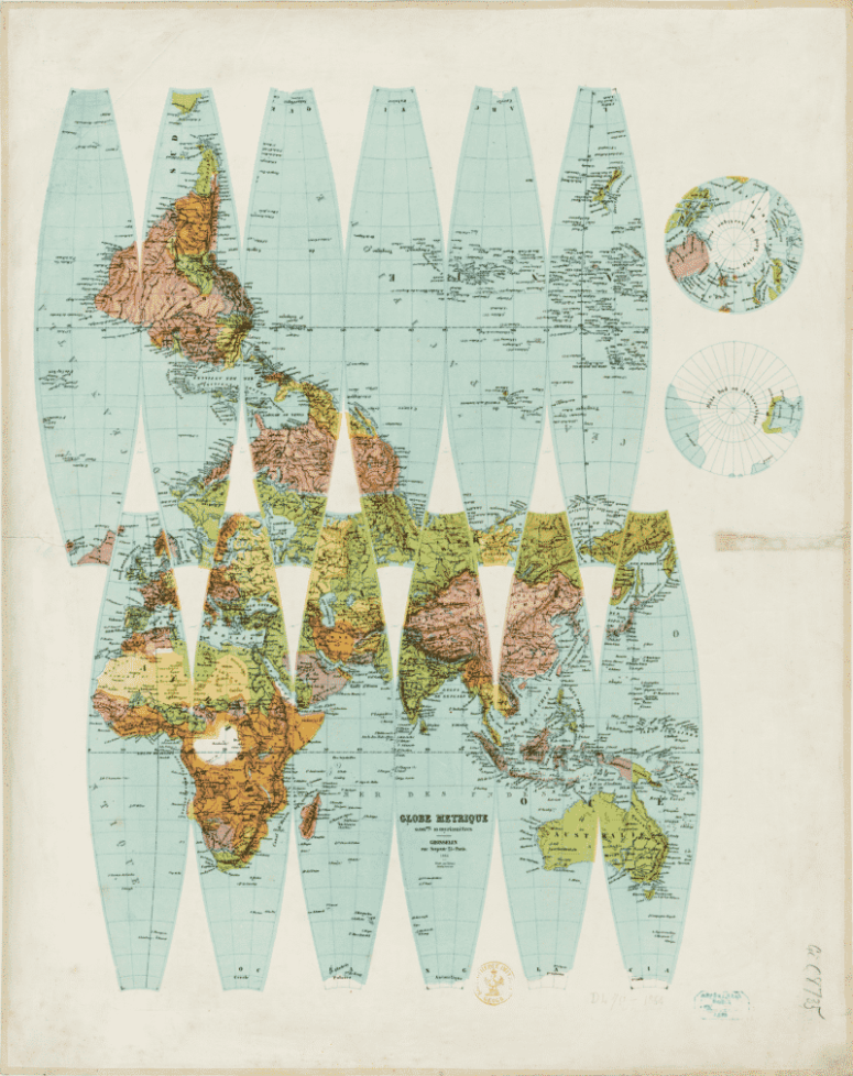
Gore Globes
This method of manufacturing terrestrial and celestial globes first appeared in the 16th century. A “gore” is a section of a curved surface that may be flattened to a plane surface with little distortion. Gores are wider in the middle and tapered at the extremities. By extension, the word is used for anything of a similar shape, such as the panels of a hot-air balloon or a parachute. A gore globe is composed of a map of the world engraved in the shape of 12 gores. The gores are then printed onto paper, cut out and glued onto a sphere. The process made it possible to manufacture globes using printing, as opposed to drawing or painting a world map directly onto a sphere.
Heliocentrism
This astronomical system broke with Ptolemy’s geocentric one by placing the Sun at the center of the Universe rather than the Earth. The model, proposed by Copernicus in the 16th century and defended by the the Italian polymath Galileo in the early 17th century, was gradually adopted by scholars, despite the Church’s opposition. Geocentric and heliocentric models coexisted in the 18th century until heliocentrism gained broad acceptance, thanks, in particular, to the work of Newton (1687) and Bradley (1728).
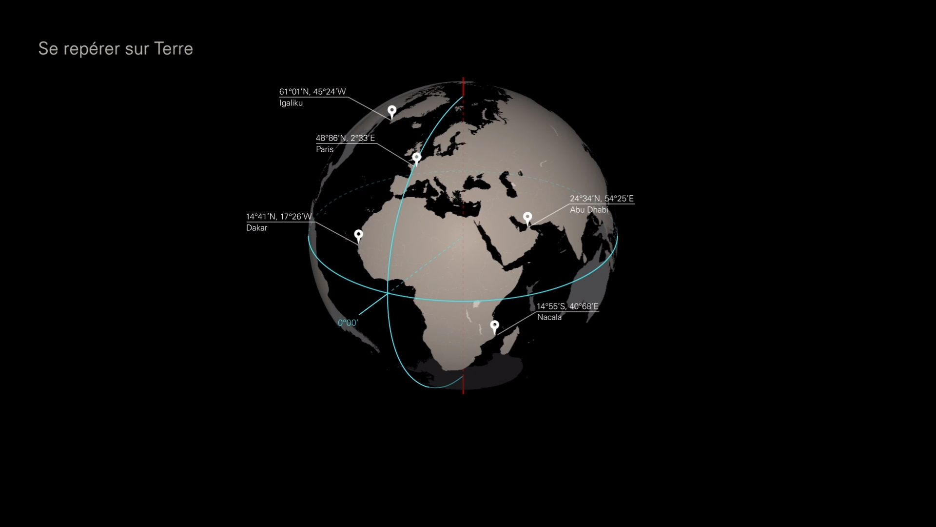
Latitude and Longitude
To get one’s bearings on a terrestrial (or celestial) globe, a grid of imaginary lines – the equator, parallels, and meridians, are drawn on it. The meridians are circles that go through both poles and make it possible to determine longitude. The parallels are circles that are parallel to the equator and are used to measure latitude. In this way, specific points (geographic places or stars) can be located by giving their coordinates in latitude and longitude.
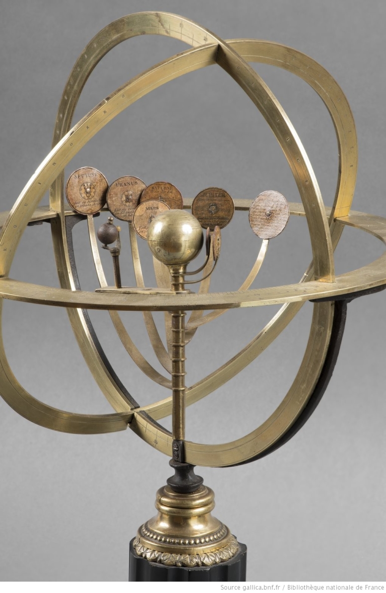
Orrery
An orrery is a mechanical model of all or part of the solar system (the Sun and its planets). The heavenly bodies represented can be manually driven or have a clockwork mechanism. They are primarily used to reproduce the planets’ motions around the sun for educational purposes. The first mechanical orreries appeared in the late 18th century. Nineteenth-century orreries gradually integrated newly discovered planets, first Uranus, then Neptune.
Scholars and Philosophers from Ancient Greece to the Middle Ages
For two thousand years, the spherical model of the universe was conceived, perfected, and challenged by scholars from all backgrounds, whether from regions dominated by the Greco-Roman tradition, or heirs of that ancient knowledge in the Islamic world, the Christian West, and as far away as India. This map locates – by place of birth or activity – the polymaths who, from Antiquity to the Renaissance, contributed to shaping and perfecting the hypothesis of a world of spheres.
> download the map as a PDF (in French) : Scholars and philosophers from Antiquity to the Middle Ages
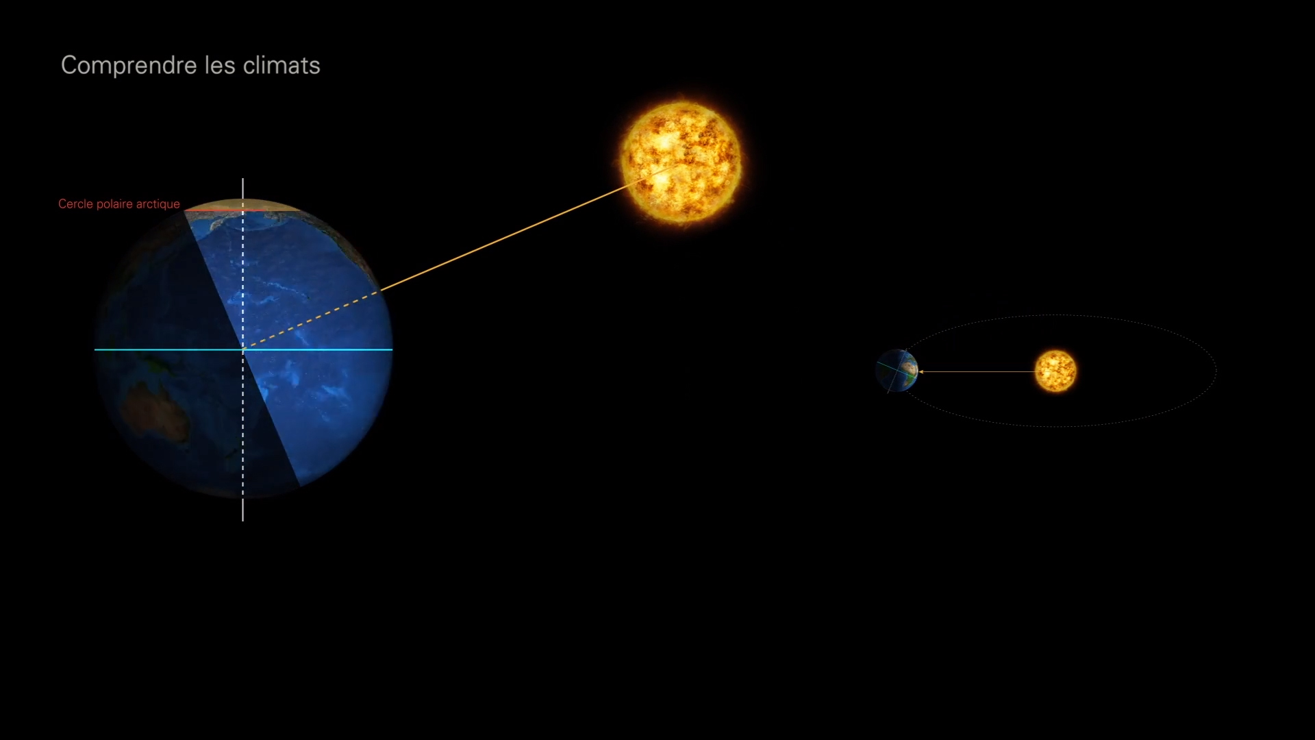
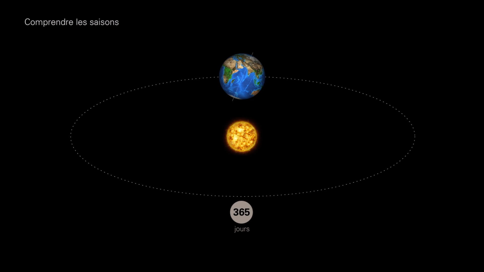
Seasons
The phenomenon of the seasons is due to the inclination of the Earth’s axis of rotation relative to its orbit around the Sun, whose height over the horizon evolves over the course of the year. Here’s an animation that explains it…
Solstice
This term refers to both times of the year when the Sun, in its apparent trajectory on the celestial sphere, is at its greatest angle relative to the equatorial plane (to the North or South), and the imbalance of days and nights is at its highest point throughout the the world.
The summer solstice occurs on June 21: it is the longest day of the year, and the first day of summer in the northern hemisphere. The winter solstice occurs on December 21: it is the shortest day of the year, and the first day of winter in the northern hemisphere.
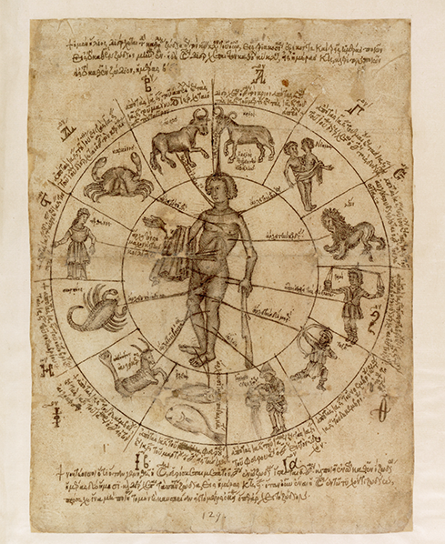
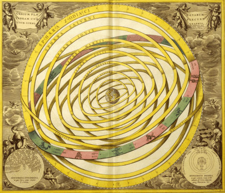
Zodiac
The zodiac is a 360°-long and 18°-wide circular section of the celestial sphere, with the ecliptic at its center. The ecliptic represents the Sun’s apparent path around the Earth. The astronomical zodiac (13 constellations that the Sun and the planets seem to PASS through during the course of a year) is distinct from the astrological zodiac (divided into 12 signs of 30° each, which get their names from the ancient constellations).