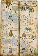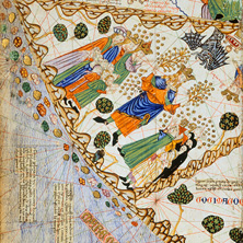
The Catalan Atlas created by Abraham Cresques in around 1375 represents the world over four maps:
two for the East, from China to the Persian Gulf, and two for the Mediterranean West, from the Black Sea to the British Isles. Place names around the Mediterranean basin, Europe and Africa correspond to those used on Catalan portulan charts at the time. Those used on the maps of Asia were taken from ancient texts, reports of Marco Polo's travels, and Arab sources.
two for the East, from China to the Persian Gulf, and two for the Mediterranean West, from the Black Sea to the British Isles. Place names around the Mediterranean basin, Europe and Africa correspond to those used on Catalan portulan charts at the time. Those used on the maps of Asia were taken from ancient texts, reports of Marco Polo's travels, and Arab sources.