Portulan Charts as Navigational Tools
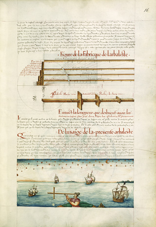
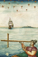
Portulan charts were rapidly adapted to the requirements of ocean-going navigation. Although early charts relied on compass directions and scales to determine routes and position, latitude measurements, calculated through astronomical observation, were included as of the 16th century, enabling navigators to determine their latitude on the globe. Longitude was not included on portulan charts until much later, because the lack of appropriate instruments meant that longitude calculations at sea remained highly unreliable until the late 18th century.
Portulan charts were rapidly adapted to the requirements of ocean-going navigation. Although early charts relied on compass directions and scales to determine routes and position, latitude measurements, calculated through astronomical observation, were included as of the 16th century, enabling navigators to determine their latitude on the globe. Longitude was not included on portulan charts until much later, because the lack of appropriate instruments meant that longitude calculations at sea remained highly unreliable until the late 18th century.